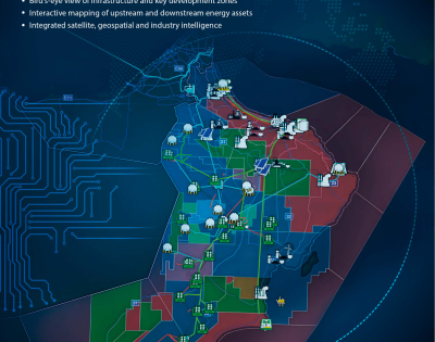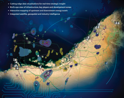
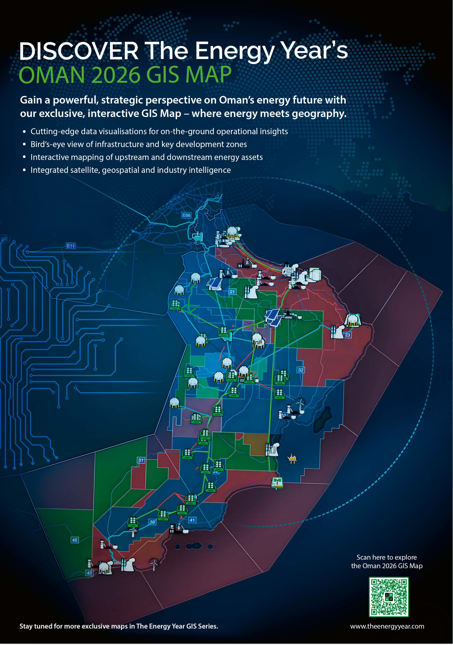

The Energy Year presents the second in its series of cutting-edge interactive maps. This multi-layered precision GIS map of Oman details the country’s energy resources and infrastructure.
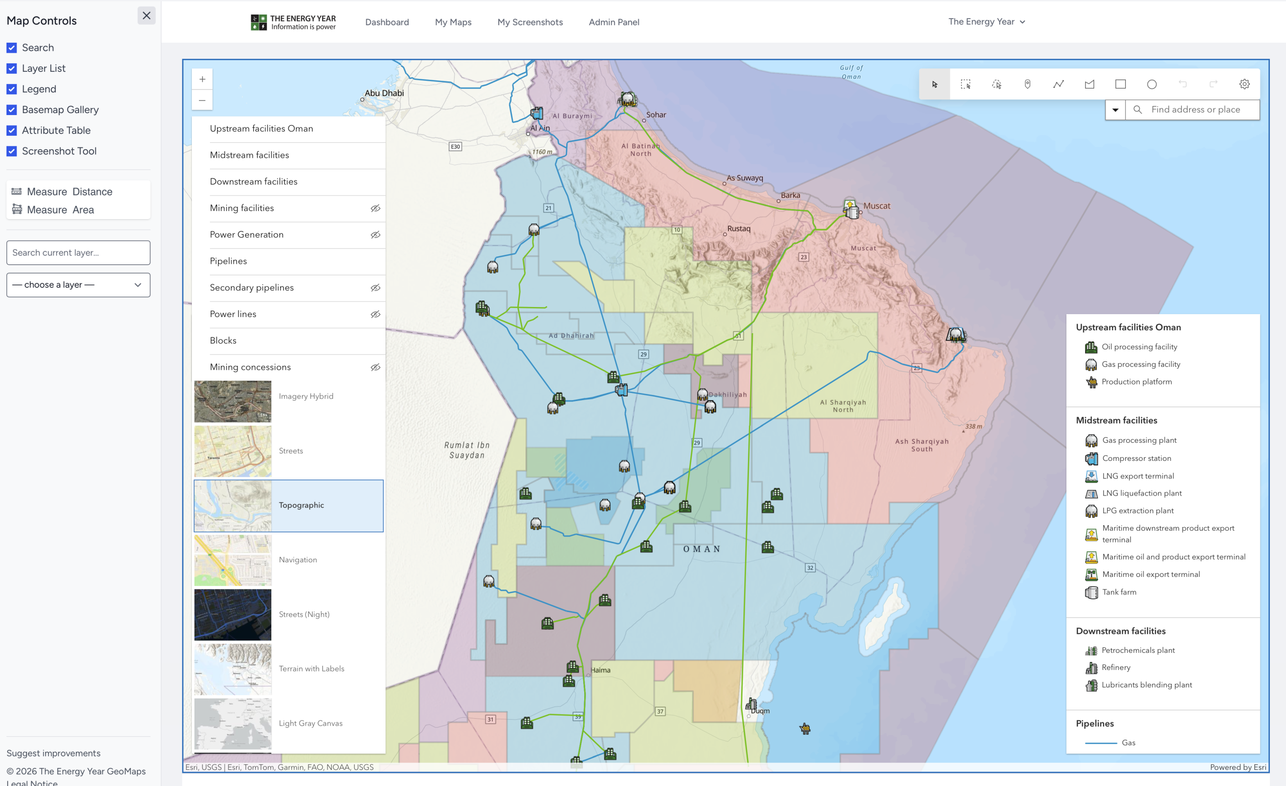
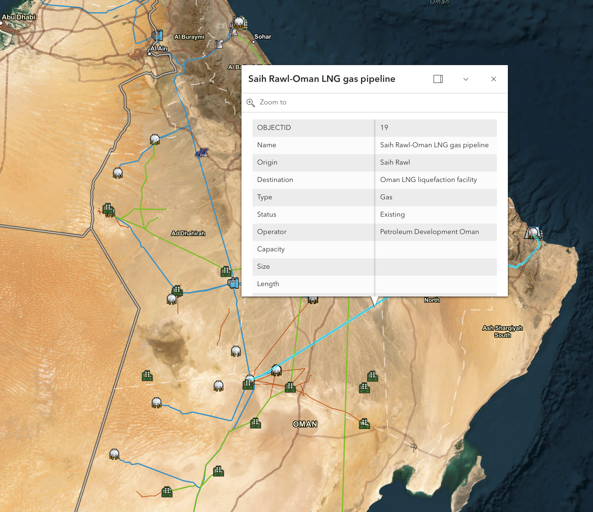
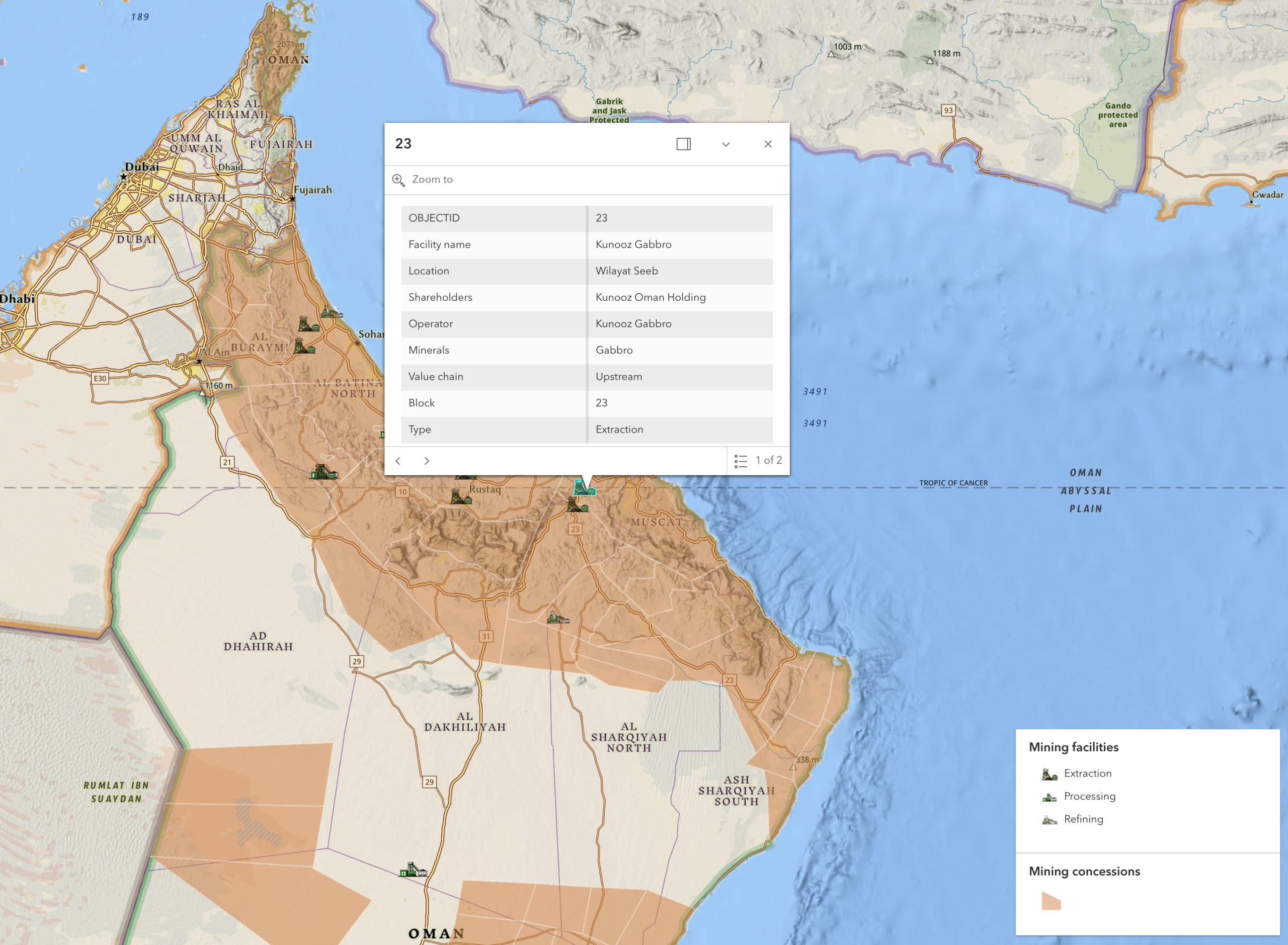
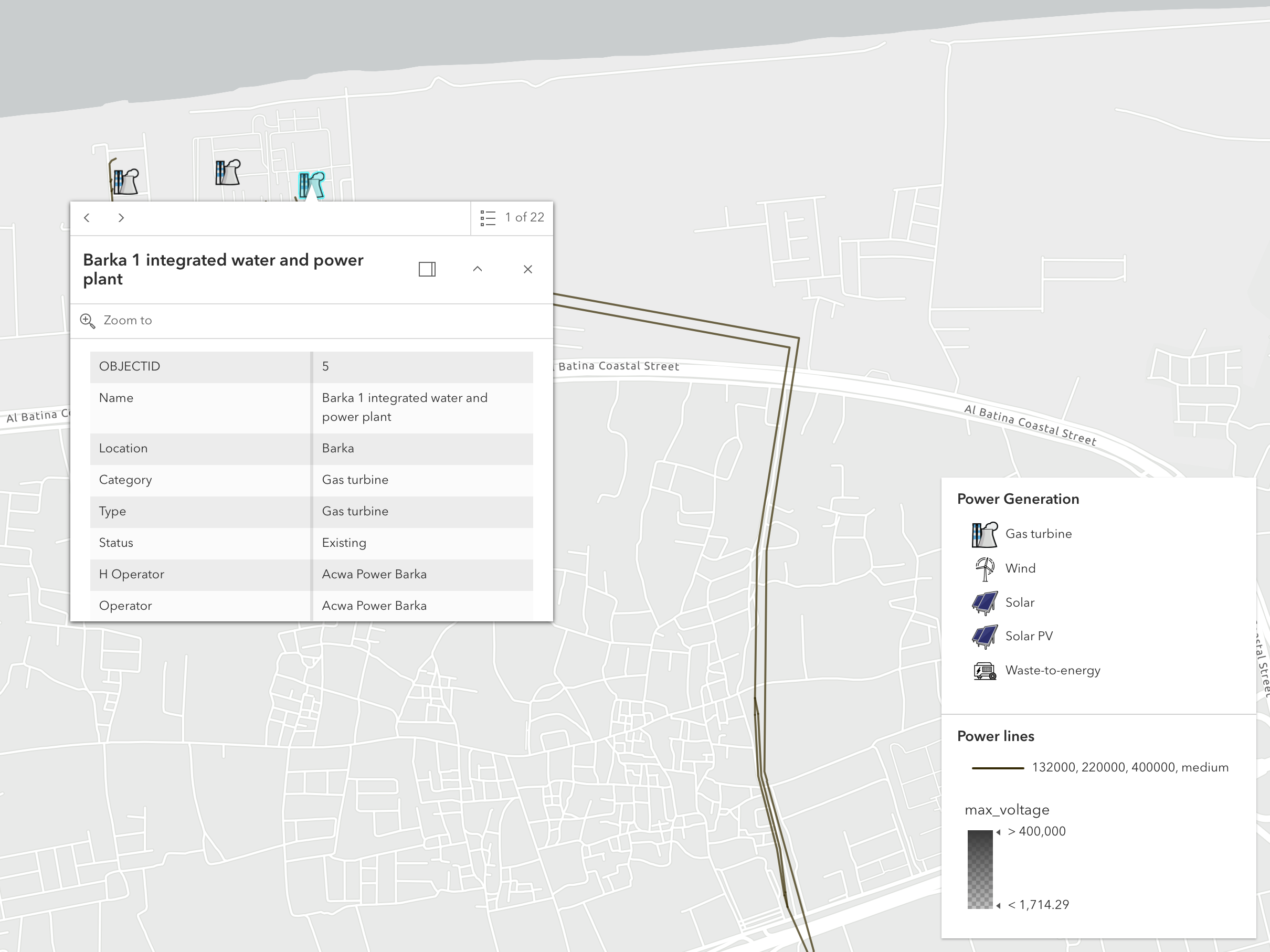
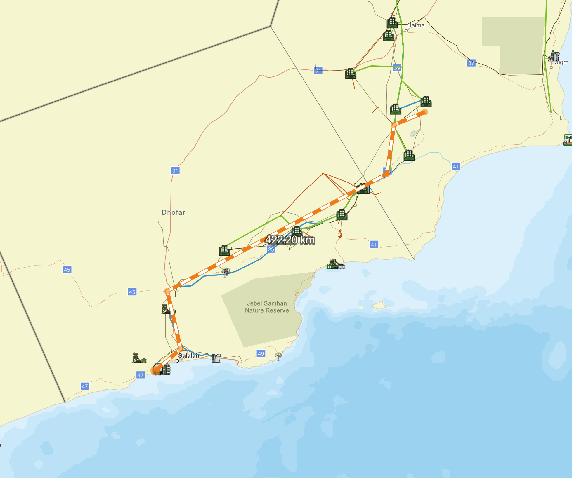
Detailed layers show oil and gas blocks, mining assets and blocks, pipelines, ports, electricity generation, electricity distribution and installations across the upstream, midstream and downstream. Satellite or terrain base maps show precise locations and routes of the items covered.
Layers can be switched on and off to change the maps focus while navigation tools permit a smooth exploration of the country’s assets.
The content is updated regularly by our team of researchers, and users can suggest improvements.